THE PROBLEM
The banks of Plum Creek and its tributaries, located in northern Calumet and southern Brown and Outagamie Counties, are highly susceptible to active bank slumping and erosion. Increased erosion and sedimentation within Plum Creek affects the water quality of the creek as well as the Lower Fox River and the Bay of Green Bay. Active slumping and erosion is caused by several factors, including:
- recent increases in the number of storm events
- recent increases in the amount of precipitation per storm event
- excess runoff from adjacent fields
- sedimentation within the stream itself causing unnatural meandering.
Luckily, there are organizations working to help find solutions and educate landowners on preventative measures to these problems.
The Fox-Wolf Watershed Alliance, with its county partners (Calumet, Brown & Outagamie), have been helping local landowners install streambank stabilizations systems and other agricultural conservation practices in an effort to reduce the sediment loading of Plum Creek. These projects are currently being funding through the Great Lakes Restoration Initiative funding.
THE PLANNING PROCESS
Before a streambank restoration project can get started, Calumet and other county staff meet with landowners to discuss the project and develop visions and goals. Topics that are typically reviewed include appropriate size, location of needed equipment crossings, maintenance, and most importantly, the overall functionality of the completed project.
After the initially planning, Calumet County staff then work with the Wisconsin Department of Natural Resources in order to come to agreements on the most appropriate ways of restoring the stream. Surveying, designing and open communications with the landowner will all need to occur in order to secure proper permitting for the project.
A RECENT SUCCESS STORY
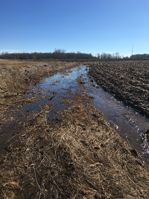
An example of a recent streambank stabilization project involved a large drainage area that drained to 1,600 linear feet of stream. This project involved hundreds of acres of diverse land uses including woodlots, agricultural lands and residential homes. This photo shows how the stream channel has filled with sediment which forced the water out fo the banks which, in turn, was causing edge of field gully erosion and additional streambank deterioration.
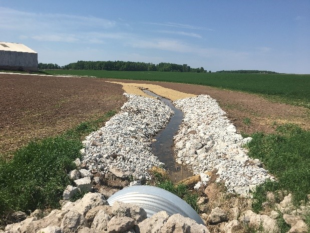
Without completion of a streambank restoration project, water flow would have continued to erode away valuable areas of the farm field. In this case, the landowner wanted to do more than just basic streambank restoration to ensure that the stream would remain stable for a long period of time. To achieve this goal, the banks were graded back to provide for a gentle side slope. In doing this, the banks are more stable and allowed the landowner to access the slopes in order to maintain the stabilizing vegetation.
Additional upgrades included an equipment crossing to provide agricultural equipment access to fields located on both sides of the stream. Lastly, to ensure that the project would have a stable outlet, large rock rip rap was added to the last 100 feet of the project area. A layer of 6″ stone was top dressed over the larger rock to prevent soil from being washed out from underneath the rip rap. The main channel was not rip rapped in order to maintain the streambed as natural as possible, providing proper water flow and maintaining natural habitat and stream flows.
In addition to the streambank protection, this project also involved 35 foot buffer strip installation along both sides of the stream. The landowner worked with Brown and Outagamie County Land Conservation Departments on this portion of the project. Once established, the permanent vegetation along the stream will help filter runoff before entering the stream channel, capturing sediment and reducing nutrients which will improve the water quality of the stream.
Once completed, project staff and the landowner agreed that the project turned out better than anticipated.
Additional projects such as this are being planned and constructed throughout the Plum and Kankapot Creek watersheds in an effort to improve the water quality of the watershed.
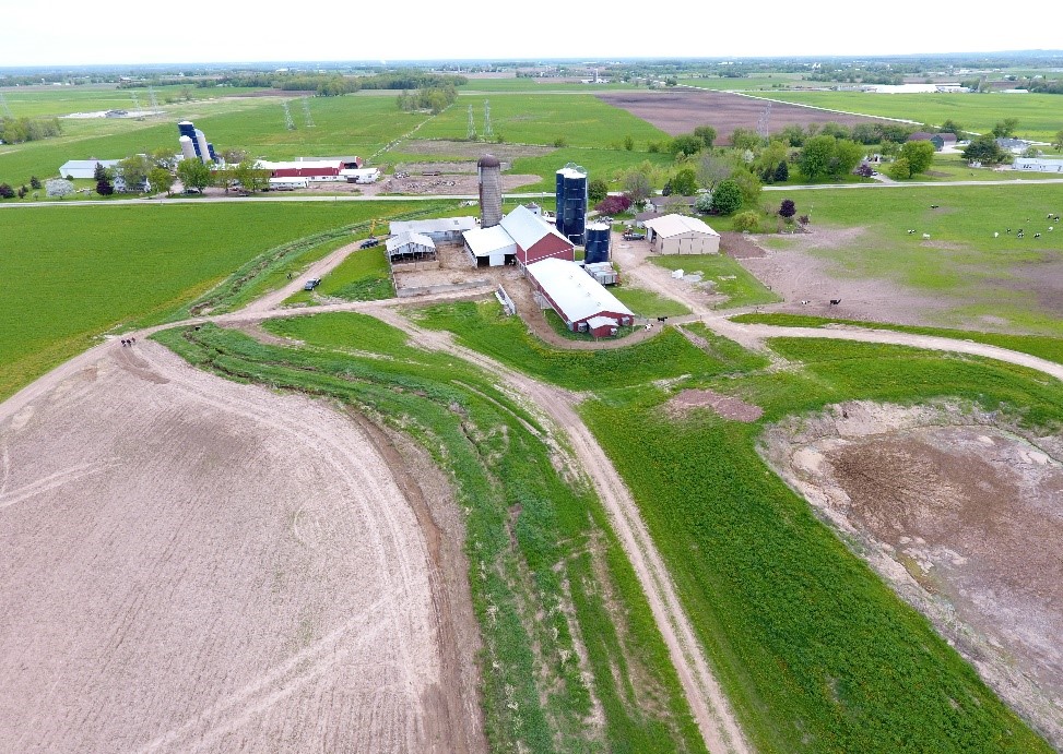
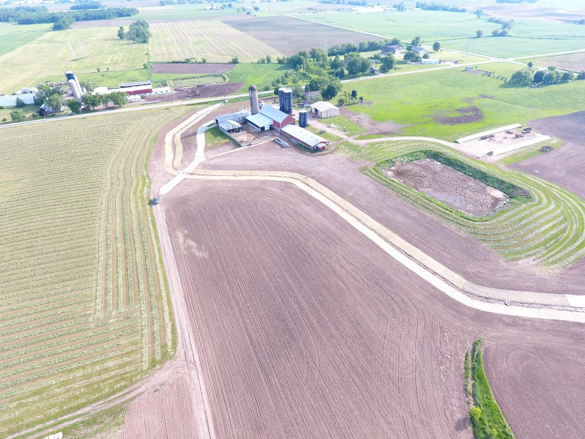
The photos below (courtesy of Outagamie County), show the farm fields and stream prior to project construction (LEFT) and after construction (RIGHT).
(Note that the 35 foot buffer strips along the streambanks were planted, but not established at the time of the picture)

Article written by
Jonathan Lisowe – Conservation Project Technician
Calumet County Land and Water Conservation Department
Posted by
Chad VandenLangenberg (chad@fwwa.org)
Fox-Wolf Watershed Alliance


