Whether you enjoy hiking, viewing wildlife, kayaking, hunting, or any other outdoor activity; clean water plays an important role. Without it, there may not be habitat for animals or excessive algae could prevent you from enjoying your activities. While you might not be able to determine overall water quality, you can probably tell when it is good or bad.
Water quality changes over time and is affected by the land surrounding it. A major source of pollution originates from water that runs off farm fields and hard surfaces such as roads and parking lots. This runoff carries soil particles and nutrients into rivers and streams. When we have large amounts of runoff that contains excessive phosphorus or sediments, we can see nuisance algae growth, reduced submerged vegetation, oxygen depletion, water clarity problems, and loss of valuable aquatic habitat. Knowing how the land is used around us helps us understand where we will experience water quality problems. Tracking water quality is difficult, as it requires samples from many points over long periods of time.
October marks the last month of sampling for the Lower Fox River Volunteer Monitoring program. This program began in 2015 to track water quality throughout the implementation of the 2012 Environmental Protection Agency (EPA) approved Lower Fox River Basin Total Maximum Daily Load (TMDL) and is funded through the EPA using Great Lakes Restoration Initiative (GLRI) funds.
Data collected from this monitoring program will be used to track water quality throughout the implementation of conservation practices and to monitor the health of the watershed overtime. We are hoping that by tracking phosphorus levels, we can gain a better understanding of which management practices are most successful in improving water quality and encourage these practices to be replicated throughout each watershed.
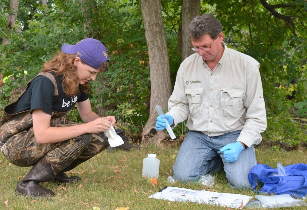
This program uses DNR trained volunteers to collect water samples on 14 rivers and streams in the Lower Fox River watershed once per month from May to October. Samples are analyzed by the Wisconsin State Lab of Hygiene for Total Phosphorus, Dissolved Reactive Phosphorus, and Total Suspended Solids, in addition to measuring flow and water clarity.
The first four years of this program have been a success! Important water quality data has been collected and we created lasting partnerships with community members and organizations. We are continually learning from past years to improve this program and hope to add sites in the future. If you would like to learn more or are interested in volunteering, please contact Ian Krauss (Ian.Krauss@Wisconsin.gov).
Written & submitted by: Ian Krauss – Wisconsin DNR Water Resources Management Specialist
E-mail: Ian.Krauss@Wisconsin.gov

