
Project Overview


In 2020, the Wisconsin Department of Natural Resources (WDNR) developed a Total Maximum Daily Load (TMDL) for the Upper Fox and Wolf River (UFW). A TMDL is a calculation of the maximum amount of a pollutant that a body of water can absorb and still meet water quality. The TMDL was utilized in the creation of the EPA’s Nine Key Elements (9KE). Within the 9KE there is a requirement for reductions in pollution to meet water quality goals. The goals within this plan are to reduce Total Phosphorus (TP) which also relates to the reduction of Total Suspended Solids (TSS) such as erosion and flooding.
Approximately 34% of the reduction from the TMDL needs to come from the Winnebago Waterways Recovery Area with 51% of that reduction assigned to agriculture. Alteration in farming practices and structural changes will help make reductions.
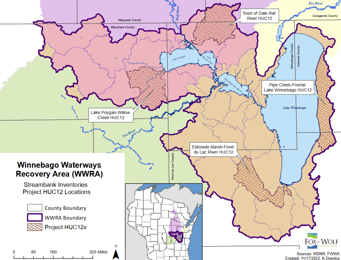
Target HUC12 Subwatersheds in the 2023 Streambank Erosion Inventory
HUC12 to be Inventoried HUC12 Code Stream Miles
Town of Dale-Rat River 040202022102 60
Eldorado Marsh-Fond Du Lac River 040302020204 63
Lake Poygan – Willow Creek 040302022006 88
Pipe Creek – Frontal Lake Winnebago 040302020303 91
Project Timeline
In the Spring of 2023, a method was developed using GIS to determine streambanks to be physically inventoried as they are representative of the HUC12 they are located in. The method developed has been recorded in SOP#1: Streambank Erosion Inventory Desktop Review so it can be duplicated.
Fieldwork was accomplished in the summer of 2023. Streambank information from the desktop review was utilized to complete a physical inventory of these sections.
December 2023 – February 2024: Streambank Inventory Data Analysis was developed along with the extrapolation. These tools will allow an estimation of sediment loss and load & phosphorus loss and load for an entire watershed.
Project Funding & Partners

")