
The goal of the Lake Management Planning project is to develop a regional framework for cooperation to restore and protect the health of the Winnebago Lakes. This includes facilitating communication among stakeholders (such as residents and lake users) and multiple agencies to advance regional efforts that address topics such as: water quality, habitat, recreation, and aquatic invasive species among others. This monthly article provides a summary of project progress as we work to complete the lake management plan (LMP) and move toward implementation of management and project recommendations.
Technical Team Progress:
Water Quality Tech Team
A sub-group of the WQ Tech Team met in August to work on the comprehensive water quality monitoring plan that will be recommended in the lake management plan. Our goal is to recommend a monitoring plan that will be consistent with other efforts in the system, including the Upper Fox and Wolf TMDL. Our next WQ sub-group meeting will be held in September.
We continued to contact people around the region to learn more about blue-green algae monitoring efforts. Illnesses related to blue-green algae exposure are now required to be reported to the WI Department of Public Health. Given the seriousness of harmful algal blooms as a public health concern, we feel it is important to address this issue in the lake management plan. If you know of any efforts to monitor for BGA in the Winnebago Lakes, please let us know. Contact Korin at korin@fwwa.org or (920) 851-0948.
Aquatic Plant Management Tech Team
Submergent aquatic plants: Cason and Associates and Wisconsin Lake and Pond Resource successfully completed full aquatic plant surveys for all four of the Winnebago Lakes. The results of the survey will be included in the lake management plan and used as a baseline for monitoring future progress.
Emergent aquatic plants: The WDNR, with assistance from Winnebago County, is in the process of mapping emergent plant beds in all four of the Winnebago Lakes. Given the size of the system and limitations of boat access in some of the higher quality and denser plant beds, Winnebago County has been mapping some of the beds by drone. Stay tuned for more information about this cool method for data collection! Similar to the submergent plant surveys, the results of the emergent survey will be included in the lake management plan and used as a baseline for monitoring future progress.
Habitat Tech Team
After exploring different options for assessing current or baseline habitat conditions in the lake management planning project area, we realized we are missing critical pieces of information needed for a single, system-wide assessment tool of all priority habitat types. Because of this, we decided to take a different approach and will be assessing the priority habitat types (previously identified by the tech team) individually, based on the information available for each habitat type. We began working on wetlands by using the ‘potentially restorable wetlands’ GIS layer available through the WDNR. We plan to use that layer in combination with land use and cover to try to identify areas where wetlands currently exist and where there is potential for restoration. Once we have that information, we can then begin to develop goals and management recommendations for wetland habitat for the lake management plan.

Click the image to view flyer
Sign-up for project updates:
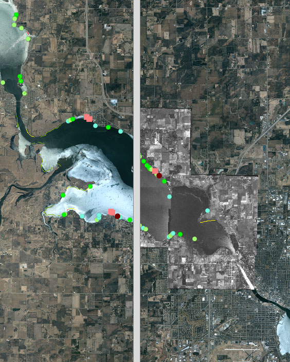
Historic Shoreline Map Viewer – developed by Winnebago County. Click the image to view.
Shoreline Practices Tech Team
Shoreline property owners survey: During the month of August, we sent over 1000 shoreline property owners an invitation to participate in an online survey to gain a better understanding of what they currently do and what they would be willing to do on their property to reduce runoff and protect the shoreline from erosion. We have received 230 responses so far (that’s a 23% response rate)! A reminder was mailed to people who have not yet chosen to participate. We anticipate the participation rate to increase over the coming weeks. We will use the results to help us develop management recommendation for the lake management plan.
Shoreline inventory: In 2014, Calumet, Winnebago and Waushara Counties had a shoreline inventory completed for shoreline that falls within in their respective counties (click here to learn more). To have a complete picture of the lakeshore for all four lakes, we will be conducting a shoreline inventory of the Fond du La County shoreline in Lake Winnebago. This is a collaborative effort among Fond du Lac County, Winnebago County, the Lake Winnebago Quality Improvement Association, and Fox-Wolf Watershed Alliance. During the inventory we will take a photographic record of the shoreline, assess severity of erosion, and record locations of woody debris and dominant vegetation present along the shoreline. The data will be used to develop goals and management recommendations for the lake management plan and will serve as a baseline to assess future progress.
Recreation Tech Team
We completed the final version of a short list of questions for boaters to learn more about what boaters would like to see improved around the lakes for recreation. Responses to those questions will help inform the LMP process. We are finalizing the cover letter/intro paragraph for the questions and plan to begin distributing the questions soon. We would like to get as many boaters to provide their responses to the questions as possible. If you have recommendations for contacts of boating organizations that we can reach out to, please contact Austin at austin@fwwa.org.
Aquatic Invasive Species Tech Team
During a busy field season, AIS Coordinator Chris is working on monitoring the Winnebago Waterways for new populations of aquatic invasive species. This work ties directly into the AIS Strategic Plan as progress continues to be made. A draft version of the AIS strategic plan should be ready for the tech team to review this fall.
Watershed Management Tech Team
The Upper Fox Wolf TMDL report was made available by WDNR in draft form in July (learn more). The Watershed Management Technical Team will be using information from this study to set land conservation recommendations that, when implemented, will work towards meeting water quality criteria in the lakes. As we work to develop recommendations for watershed management we feel it is important to build relationships with people who work on and care for the land. This month, project staff participated in a Women Caring for the Land Workshop in Omro on August 14th (learn more), Conservation Field Day in Fond du Lac, and the Fond du Lac Producers Group meeting.
Community Engagement
The organization questionnaire is in its final draft form. The last step before we distribute the questionnaire is to draft a cover letter. The goal of the questionnaire is to gain a better understanding of the interest and capacity of organizations/clubs from around the Winnebago Lakes to implement management recommendations outlined in the LMP. Once we have an approved lake management plan for the Winnebago Lakes, qualified organizations and clubs will be able to apply for funding to tackle issues or projects listed in the LMP.
We also offered free boat tours of Lake Butte des Morts at Fox-Wolf Watershed Alliance’s Clean Water Makes Better Beer event that was held on August 23rd. CLICK HERE to read about the results of that event.
Water Level Management
The U.S. Army Corps of Engineers regulates water levels in Lake Winnebago and its outflow to the Lower Fox River at the Menasha and Neenah dams. They are mandated by the Federal government under a Marshall Order to maintain Lake Winnebago at or below flood stage to reduce downstream flooding during spring snowmelt and heavy rains (3.45 feet Oshkosh Datum aka the crest of the Menasha Dam). After the threat of spring flooding has passed, the lake level is gradually raised during the spring season to its summer target (3 ft) for navigation and recreational boating (info was taken directly from the US ACOE Lake Winnebago Factbook).
While the Army Corps has taken steps in recent years to better manage water levels for habitat according to the Linde Plan, there is a growing group of diverse stakeholders who think water level management could be slightly altered within the Army Corps mandated operating thresholds to see marked improvement in lake water quality without substantially compromising navigation during boating season. The basic idea is that if we see slightly lower water levels in the spring (slower refill), aquatic plants have a better chance of growing tall enough to be able to handle peak summer water levels. This means the lakes would have more plants to stabilize the sediments. Those plants would also take up more nutrients leaving less available nutrients for algae. Simply put, more plants equals less algae and better water quality. We are in the process of reviewing relevant data and plan to draft management recommendations as part of the lake management planning process.
The Army Corps holds an annual regulation meeting that is open to the public. During that meeting, they listen to comments from the public about water level management. This year, the meeting will likely be held during the second week in October. As soon as we have a confirmed meeting date, we will share it on our website and on our Facebook page.
Project Outreach and Engagement
We attended several events and meetings to promote lake management planning throughout the month of August. Some highlights from our staff were:
- Participated in the Lake Winnebago Quality Improvement Association’s Annual Member Meeting on August 4th
- Participated in a Women Caring for the Land Workshop in Omro on August 14th
- Attended the Conservation Field Day in Fond du Lac on August 14th
- Participated in the Fond du Lac Producers Group meeting on August 14th
- Attended the Lakes Partnership Summer Meeting August 16th
- AIS Snapshot Day 2018 took place on August 18th. Read more here...
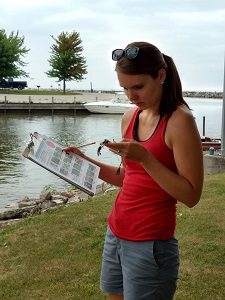
Volunteer looking for AIS on Snapshot Day 2018
- Participated in the Upper Fox/Wolf Save the Bay meeting on August 21st
- Clean Water Better Beer event was held on August 23rd. Read more here…
- Exhibited at Mills Fleet Farm Outdoor Show August 24th and 25th
Our online presence through our project webpages, e-newsletter, and social media continues to grow. We invite you to follow us on Facebook or Twitter!
Winnebago Waterways Steering Committee
The Steering Committee held their latest meeting on August 10th, 2018 as a conference call. CLICK HERE for meeting information and notes.
The next Steering Committee meeting will be in person on September 21st from 11:30 am to 1:30 pm in the Fond du Lac City/County Government Center. Meetings are open to the public. For a meeting agenda, please contact Korin Doering at korin@fwwa.org or (920) 851-0948 or check our website closer to the meeting date. Check HERE for meeting details.
Winnebago Waterways Executive Committee
The next Winnebago Waterways Executive Committee meeting is scheduled for September 21st, 2018 at 9:30am in the Fond du Lac City/County Government Center.
Questions? Contact Korin Doering, Winnebago Waterways Program Coordinator, at (920) 851-0948 or korin@fwwa.org.
Winnebago Waterways is a Fox-Wolf Watershed Alliance program. The Fox-Wolf Watershed Alliance is an independent nonprofit organization that identifies and advocates effective policies and actions that protect, restore, and sustain water resources in the Fox-Wolf River Basin.
Follow the Fox Wolf Watershed Alliance’s Winnebago Waterways Program on our Facebook pageor @WinnWaterways on Twitter! You can also sign-up for email updates at WinnebagoWaterways.org.