
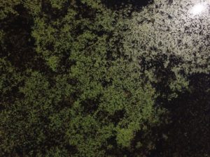
Aerial view of emergent plant beds. Photo: WDNR
Acquiring information is one of the most important and necessary components of developing an accurate and comprehensive lake management plan. Winnebago County and the WDNR recently completed mapping the existing beds of emergent vegetation on the Winnebago system (in Winnebago County). Emergent plants root themselves in the lake bottom, but their stems and leaves extend out of the water. Submergent aquatic plants maintain growth within the water column or at its surface.
This new information is useful in multiple ways. First of all, it gives us a baseline for comparison. It is difficult to evaluate progress and the success of projects, like aquatic plant restoration, without knowing where the system was previously at. Additionally, their work gives insight into what species might be successfully reestablished. For example, if we know a given plant species grows really well at a certain depth in a particular substrate, we will probably see success trying to reestablish it in a similar locale.
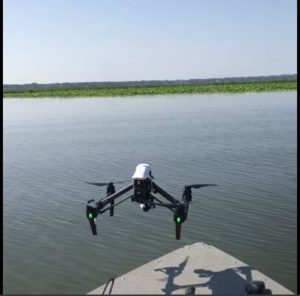
Drone used for aerial imagery Photo: WDNR
Winnebago County and the WDNR used a drone to take aerial photos of the emergent plant beds and used GPS to map the perimeter of the beds. This imagery and spatial data is the information that helps lake managers evaluate the success of lake improvement projects.
The County and the WDNR found that pockets of emergent plants tended to be in locations that provided protection from wind and wave energy. This was likely observed because the lake’s turbidity constantly hammers away at the bottom of the lake, making it inhospitable to plant growth. Turbid waters act like the rabbit that eats your tender carrot seedlings. You’ll have a hard time growing carrots until you deal with the rabbit. Areas protected by break walls or tucked away in bays are less impacted by turbidity and wave energy, which allows for plant establishment. You can read more about how wave energy affects plant establishment and how break walls work to promote plant growth HERE. Exceptions to this trend were a handful of Phragmites beds in the middle of each of the pool lakes.
 The county found that stands usually consisted of either one monotypic species or had a diversity of species. Some of the pockets that had the highest density and diversity of plants could be found in Boom Bay (Poygan), Clark’s Bay (Winneconne), and Sunset Bay (Butte des Morts). Common species observed were American lotus (Nelumbo lutea), Native Phragmites (Phragmites australis subs. americanus), Hardstem bullrush (Schoenoplectus acutus), White water lily (Nymphaea odorata), and Spatterdock (Nuphar variegata).
Putting in the effort to acquire data helps ensure that the limited resources available for future projects are most effectively used. This new information helps direct and guide future lake improvement projects. The Lake Management Plan will incorporate and consider this information when drafting the LMP’s management recommendations.
Winnebago Waterways is a Fox-Wolf Watershed Alliance program. The Fox-Wolf Watershed Alliance is an independent nonprofit organization that identifies and advocates effective policies and actions that protect, restore, and sustain water resources in the Fox-Wolf River Basin.
Follow the Fox Wolf Watershed Alliance’s Winnebago Waterways Program on our Winnebago Waterways Facebook page or @WinnWaterways on Twitter! You can also sign-up for email updates at WinnebagoWaterways.org.
This post was written by Austin Pethan for the Winnebago Waterways Program. Questions or comments? Contact Austin at austin@fwwa.org or (920) 920-851-4295.