

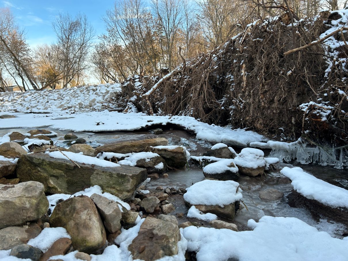
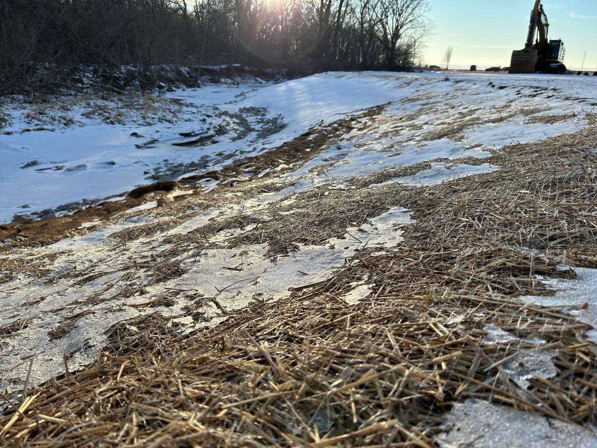
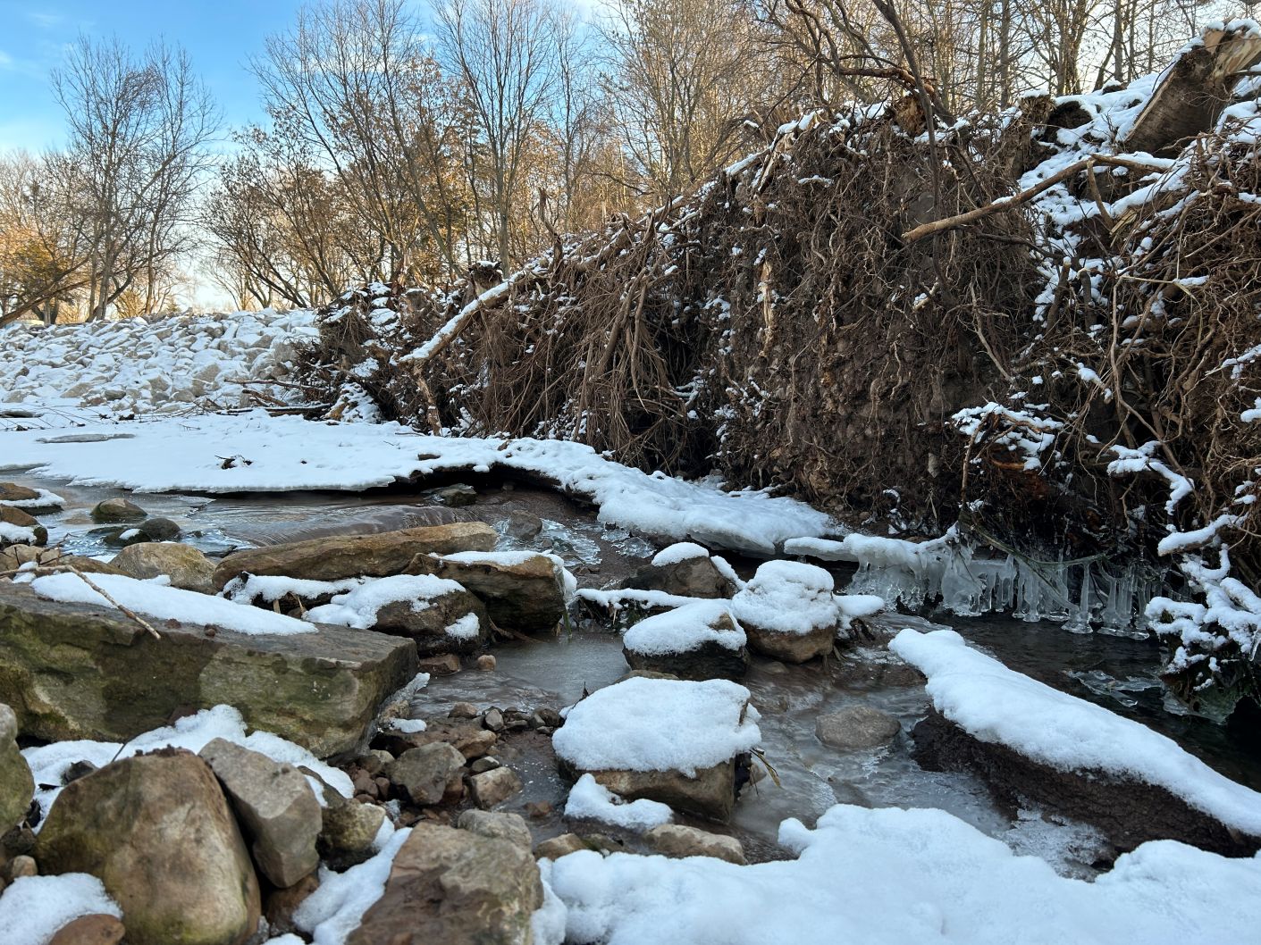
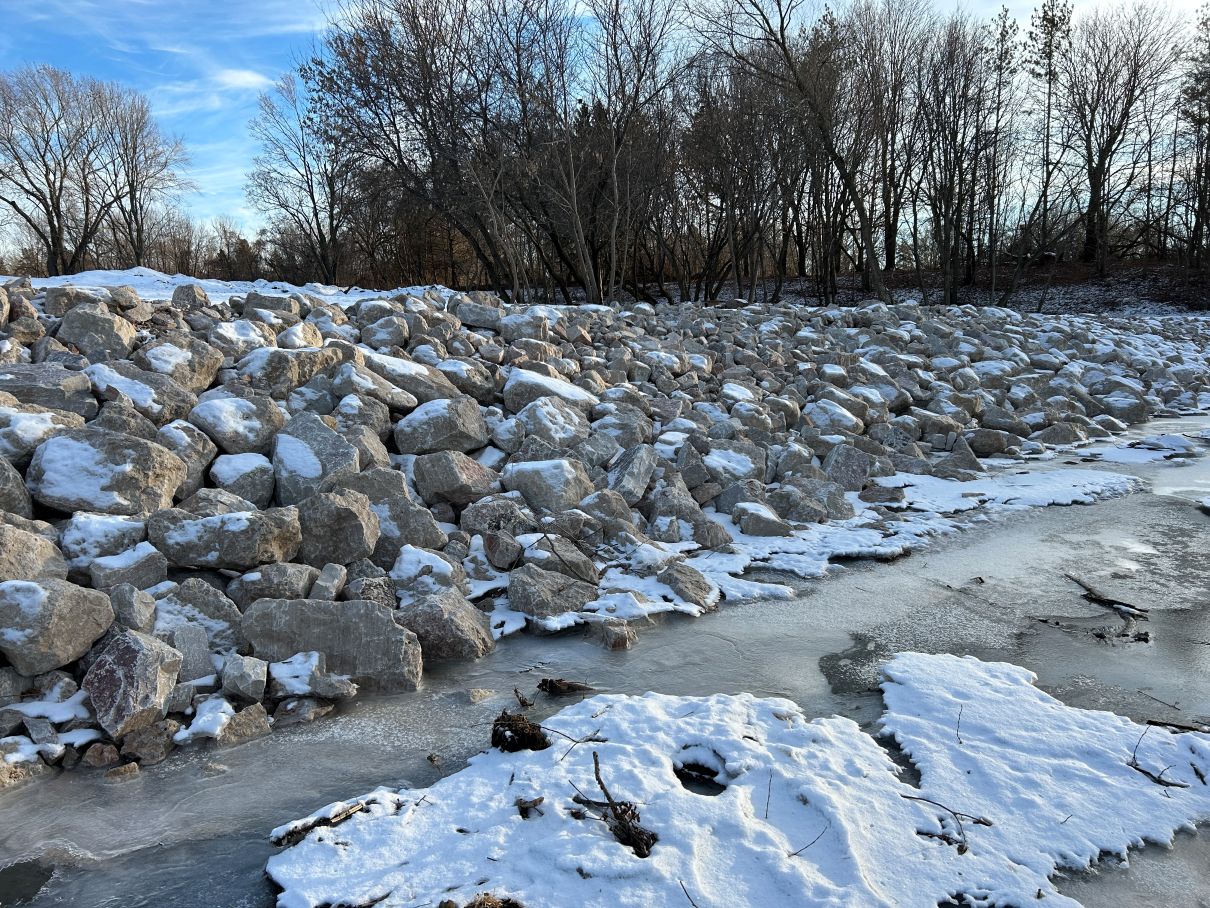
Construction Update
Construction has wrapped on the Brothertown Creek streambank restoration! Learn more here →
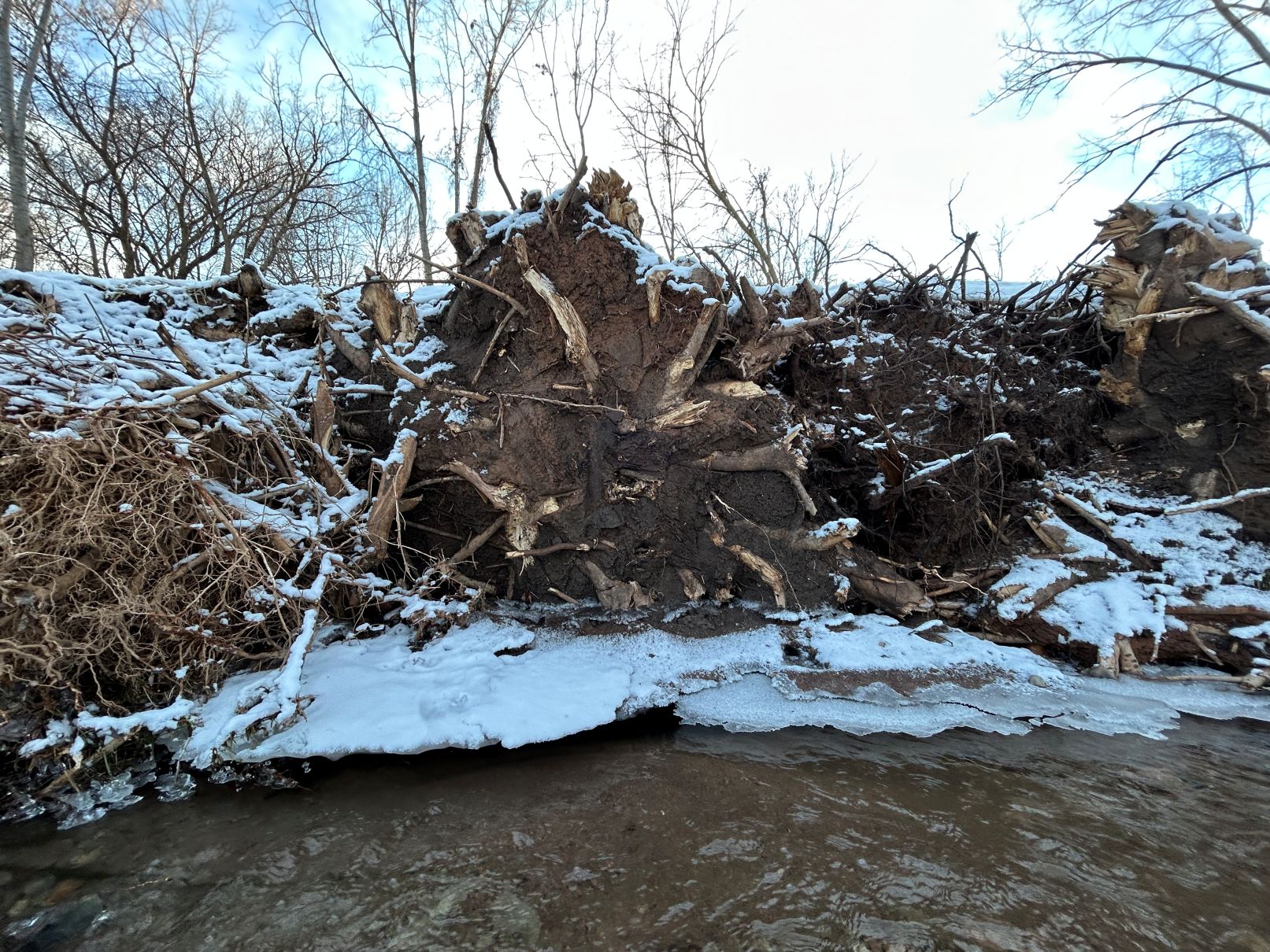
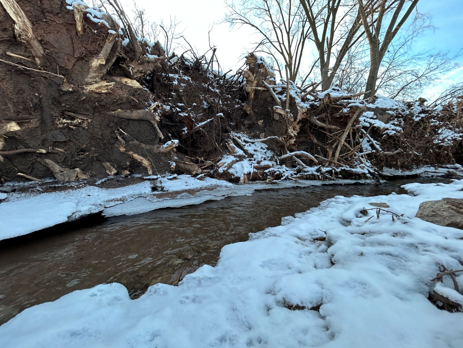
- Streambanks were regraded to slope more gradually, allowing water to flow through the creek all year without causing severe erosion.
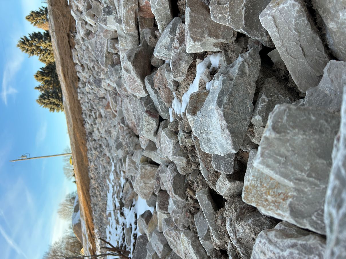
- Rip-Rap was laid strategically to prevent erosion on sharp corners and bends.
- Rootwads were placed to help direct the water’s flow away from the banks on shallow corners. They will also provide habitat for fish!
- Winter seeding of native plants was done further up on the streambanks to ensure that come spring, their deep roots will hold the streambank soil in place.
About the Project
Fox-Wolf Watershed Alliance has partnered with Calumet and Fond du Lac Counties to renew the East Shore of Lake Winnebago in the Pipe Creek Watershed.
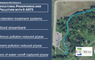
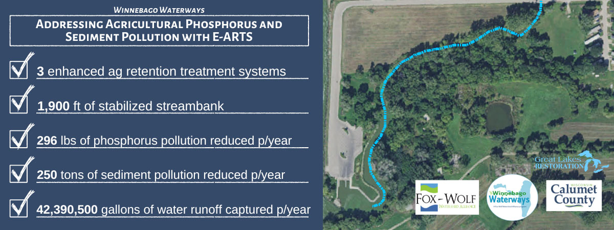
With this project, we will restore over 1/4 mile of Brothertown Creek streambank and install up to 3 ARTS in the watershed. This will not only stop hundreds of pounds of phosphorous and tons of sediment from entering Lake Winnebago, but also provide wildlife habitat, prevent future downstream erosion, and reduce flooding for homeowners and farmers.
Check out our project’s goals:
What’s the Problem?
Runoff, Flooding, & Erosion
The Pipe Creek Watershed is nestled between the Niagara Escarpment to the east, and Lake Winnebago to the west (making for some of the most beautiful sunsets in the watershed). Changes in the landscape have resulted in a watershed that can no longer store runoff. Coupled with the steep slopes of the Escarpment, there is too much runoff moving too quickly.
Learn more about why this matters →
Fox-Wolf Watershed Alliance has partnered with Calumet and Fond du Lac Counties to restore some of the most eroded streambanks in the watershed and create more storage with ARTS to help prevent future erosion. Together, this will create a watershed that is better equipped to handle runoff and stop pollution from entering the lake.
Project Location
The narrow Pipe Creek Watershed is located along the east shore of Lake Winnebago, running through both Calumet and Fond du Lac Counties.
The Pipe Creek Watershed is a part of the Winnebago Waterways Recovery Area (WWRA). The WWRA is a section of the larger Upper Fox-Wolf Basin. The watersheds within the WWRA drain directly into the Winnebago Pool Lakes – Lake Poygan, Winneconne, Butte des Morts, and largest, Winnebago.
Water in the Pipe Creek Watershed is in a unique position due to how close it is to Lake Winnebago. Instead of running a long distance of land, streams, and creeks before reaching a larger waterbody, water here has a short trip before ending up in Lake Winnebago.


Project
information
Check back soon for more information on the project groundbreaking and Community Tour!
Project Partners

Project Funder

Project Updates
Brothertown Creek Streambank Construction Finishes
Construction Wraps on Brothertown Creek Streambank Restoration banks regraded, rip-rip laid, & seeds sown In January 2026, construction [...]
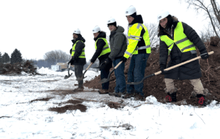
We’re Breaking Ground in Brothertown! Brothertown Creek Streambank Restoration Begins
We're Breaking Ground in Brothertown! streambank restoration work begins on Brothertown Creek Partners gathered along Brothertown Creek this [...]
Addressing Phosphorus and Sediment Pollution in the East Winnebago Watershed
Subscribe to receive updates Project Overview The Winnebago Waterways Program (WWP) at Fox-Wolf Watershed [...]